


- West Thumb Geyser Basin Trail is a 1/2 mile hike along a boardwalk that meanders above a number of hot springs.
- Yellowstone Lake Overlook Trail is a moderate 2 mile hike that leads to a stunning overlook.
- Duck Lake Trail is a moderate 1 mile hike through a fire struck wilderness to a lookout point.
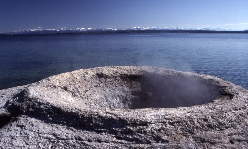
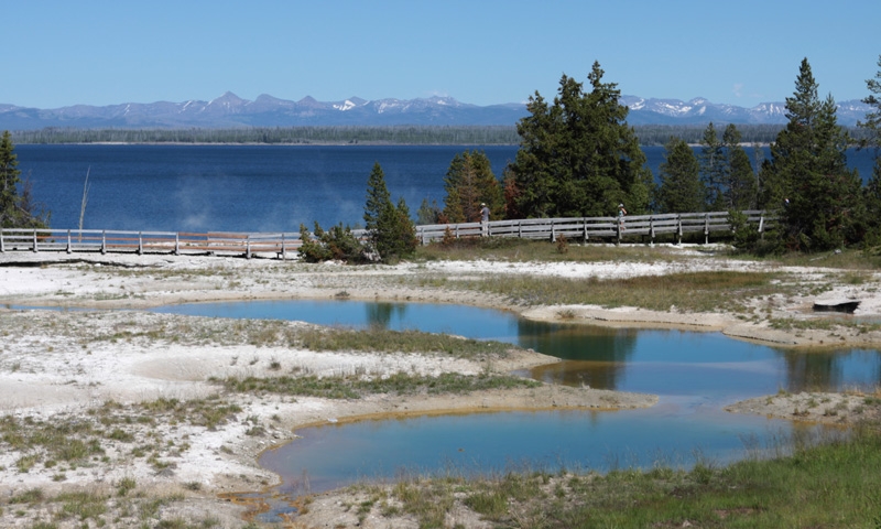
West Thumb Geyser Basin Trail
This easy boardwalk trail meanders by hot springs, colorful pools, and dormant geysers, all along the shores of Yellowstone Lake.
- Trailhead: West Thumb Geyser Basin parking area, just north of West Thumb Junction.
- Distance: 3/8 mile round-trip
- Difficulty: Easy
Yellowstone Lake Overlook Trail
This short but steep trail offers expansive views and a few backcountry thermal features.
- Trailhead: Across the parking area from the West Thumb Geyser Basin.
- Distance: 2 miles round-trip
- Difficulty: Moderately Strenuous
Duck Lake Trail
A short but steep climb up a hill, through an area affected by the 1988 fires, and then down to the shores of Duck Lake.
- Trailhead: North end of the West Thumb Geyser Basin parking area.
- Distance: 1 mile round-trip
- Difficulty: Moderately Strenuous
Shoshone Lake
This lovely trail meanders through forest and meadows until it reaches the largest backcountry lake in the park, Shoshone Lake. Backcountry trails continue on from the lake.
- Trailhead: 8.8 miles west of West Thumb Junction.
- Distance: 6 miles round-trip
- Difficulty: Easy
Riddle Lake
This trail runs through heavy grizzly habitat and does not open until July 15th. It is recommended to travel with groups of 4 or more people. The trail itself is easy and meanders through meadows until it reaches the pristine Riddle Lake.
- Trailhead: 3 miles south of the Grant Village intersection (look for the Continental Divide sign).
- Distance: 4.8 miles round-trip
- Difficulty: Easy
Dogshead Loop and Lewis River Channel
This is a great backcountry trail that is easily accessible. From the trailhead follow the trail along Lewis River. You can create a shorter version of this trail by turning around at the lake. For the full 11 miles continue on to Shoshone Lake and then back along the Dogshead Loop trail.
- Trailhead: 5 miles south of the Grant Village intersection, park north of Lewis Lake on west side of road.
- Distance: 11 miles
- Difficulty: Moderately Strenuous


