
- See the impressive Bitterroot Mountains, combining the trip with your Yellowstone vacation.
- View the plentiful wildlife in their natural environment.
- Take part in all the summer and winter activities available.
- The distance to Yellowstone from this area is only about 350 miles, making it well worth your time.
Overview
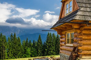
The Bitterroot Mountains are impressive as they create the border between the Idaho Panhandle and western Montana. Stretching north to south, they push their lofty peaks high, to a topmost elevation of 10,157 feet (the highest summit of Trapper Peak).
Seasons
You can visit the Bitterroot Mountains any time of year. Spring, summer and fall are best for recreational pleasures such as camping, hiking and biking. In the winter you’ll find snow sports that appeal to all ages.
More Info
Within the Bitterroot Mountain Range, you’ll discover Bitterroot National Forest, which spans over one million acres. There are also two major rivers here, the Salmon and the Selway Rivers.
A wide variety of wildlife lives in the Bitterroot Mountains. Mountain lion roam the forests, as do elk, bighorn sheep and moose. You may also spot a black bear or two.
Never-ending possibilities exist for outdoor recreation. Fish for rainbow or brook trout in the many lakes and streams. With more than 1,500 miles of trails, you can hike, ride horseback or bike to your heart’s content. Rafting is a favorite in the summer, while the winter months provide incredible skiing and snowmobiling.
Getting Here
Arriving to Yellowstone National Park from the Bitterroot National Forest area is easy!
Simply get on US Highway 93 and head south to Montana 43. Follow this highway to Montana 278 then take I-15 north to exit 63. Then take Montana 41 to US/MT 287 and follow the signs to the West Entrance.


