West Thumb & Grant Village in Yellowstone National Park

Photo © National Park Service

Photo © National Park Service

Photo © National Park Service
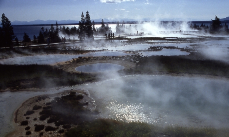
Photo © National Park Service

Photo © National Park Service
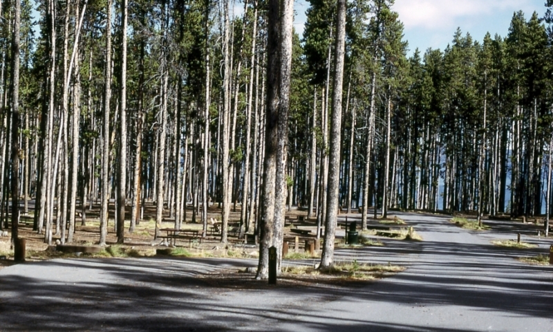
Photo © National Park Service
Located right on the shores of Yellowstone Lake, West Thumb and Grant Village offer boardwalk trails, numerous hiking trails, camping and lodging, dining, and some services.
Things to Do and See
- West Thumb Geyser Basin
Stroll along the boardwalk trail and visit geothermal features like the stunning Abyss Pool. - Yellowstone Lake
Grant Village and West Thumb are located right on Yellowstone Lake. Check out the steam vents and geothermal features right on the lake or join a sea kayaking tour and explore the lake's vast waters. - West Thumb Visitor's Center
The Grant Visitor Center has an exhibit showing information on the 1988 fires and how the fire affects the environment, as well as a movie entitled Ten Years after the Fire, shown regularly during the summer. - Hike to Shoshone Lake
Explore the largest of Yellowstone's backcountry lakes, easily accessible via hiking trail from West Thumb.
Lodging and Camping
- Grant Village Lodge
Stay in one of two lodges conveniently located in Grant Village. - Grant Village Campground
A great campground in the woods on Yellowstone Lake, the Grant Village Campground is located an easy 22 miles from the South Entrance.
Questions & Answers
Other West Thumb & Grant Village Resources
Colter Bay
Lodging, camping and marina on Jackson Lake in Grand Teton National Park.