Yellowstone National Park Mountains, Mountain Ranges

Photo © ange062 - Flickr
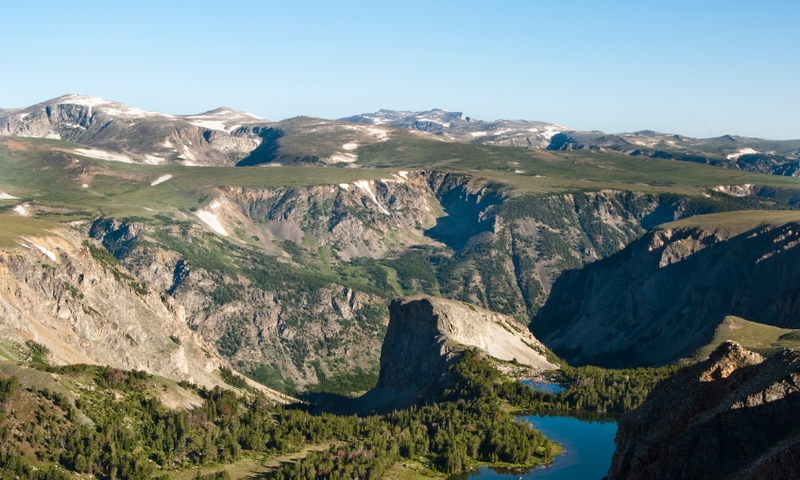
Photo © iStockPhoto

Photo © Dr. Doc - Flickr

Photo © National Park Service

Photo © Tim Bradshaw - AllTrips.com
Filled with geothermal features and huge lakes, it's easy to forget about the mountains that make up Yellowstone National park.
Yellowstone Caldera
At 45 miles long and 28 miles wide, the Yellowstone Caldera is a sort-of reverse mountain. In some places you can see the distinct drop off from the Caldera rim into the basin that makes up most of Yellowstone.
Mount Washburn
Two hiking trails lead to the top of Mount Washburn, which sits at 10,243 feet.
Gallatin Mountain Range
The Gallatin Range sits at the northwest corner of Yellowstone National Park. It's easy to access via many trailheads along US 191 between West Yellowstone and Big Sky Montana.
Beartooth Mountain Range
In the norhteast corner of Yellowstone the Beartooth Mountain Range is easily accessible via the famous Beartooth Highway, between Cooke City at the Northeast Entrance and the town of Red Lodge Montana.
Red Mountains
A small mountain range towards the southern end of Yellowstone, the Red Mountains encompass Mount Sheridan and Factory Hill. Heart Lake is a great hiking trail that offers access into the Red Mountains.
Questions & Answers
In the Spotlight

Other Mountains Resources
Scenic, jagged mountain features in South Dakota's Black Hills.
Striking mountains stretching from Big Sky to West Yellowstone.
One of the main mountain ranges enclosing Yellowstone National Park.
The Bridger Mountains provide a beautiful backdrop for Bozeman Montana and the Gallatin Valley.